


Greenacres Voting District, Okanogan County, Washington
About
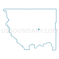
Outline

Summary
| Unique Area Identifier | 687683 |
| Name | Greenacres Voting District |
| County | Okanogan County |
| State | Washington |
| Area (square miles) | 3.20 |
| Land Area (square miles) | 3.20 |
| Water Area (square miles) | 0.00 |
| % of Land Area | 100.00 |
| % of Water Area | 0.00 |
| Latitude of the Internal Point | 48.48058390 |
| Longtitude of the Internal Point | -119.50901310 |
Maps


Graphs
Select a template below for downloading or customizing gragh for Greenacres Voting District, Okanogan County, Washington


Neighbors
Neighoring Voting District (by Name) Neighboring Voting District on the Map
- Johnson Creek Voting District, Okanogan County, WA
- Lime Belt Voting District, Okanogan County, WA
- North Omak Voting District, Okanogan County, WA
- Omak River Voting District, Okanogan County, WA
- Riverside City Voting District, Okanogan County, WA
- Riverside Rural Voting District, Okanogan County, WA